
San Diego Rainfall Patterns 2025–2026 Detailed Breakdown
I’ll be honest: when I first went through the rainfall notes behind this dataset, I caught myself thinking, “San Diego… rain… really?” If you picture Southern California as endless blue skies and sunglasses weather, you’re not alone. Yet these logs—kept by a local observer in the inland hills between coastal North County and the county’s interior—tell a more nuanced story.
In this article, I’ll walk you through what the record shows for 2025 and early 2026: which months were notably wet, how storm sequences stacked up, what wind looked like alongside the rain, and how the observer compared totals across nearby communities and the National Weather Service (NWS) reporting points mentioned in the notes. I’ll keep it practical, because if you’re a marketer, analyst, homeowner, traveller, or just a weather nerd (I can relate), you want the “what happened” and the “so what” in plain English.
One important housekeeping note: the source reads like a personal station log from an elevated neighbourhood (listed as 777 feet) with comparisons to other places around San Diego County. I treat those comparisons as the observer reported them, rather than claiming each number as an official county-wide fact. Still, the pattern is clear enough to be useful.
What the dataset actually is (and why it matters)
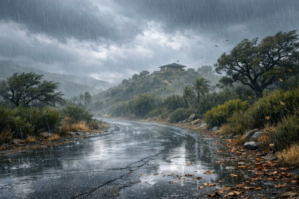
The rainfall account comes across as a careful, day-by-day journal: amounts in inches, short descriptions of intensity (light rain, heavy showers), a couple of notes about wind gusts in miles per hour, and periodic comparisons to other reported totals around the county—plus a few remarks about snow in nearby mountain areas during winter storms.
If you’re used to clean, tabular climate summaries, this kind of log can feel a bit “kitchen table,” but that’s also the charm. These notes capture the lived experience: rain starting mid-morning, a front coming through, a heavy burst in the afternoon, and the sense of how localised some storms can be.
How I recommend you use this breakdown
- If you live in the region: treat this as a storm-by-storm narrative that matches what you likely felt on the ground.
- If you work with planning or operations: focus on clusters of storms (like mid-February 2026), because that’s when flooding and saturated soils become more likely.
- If you publish content or run campaigns: note the seasonality and the “surprise factor” of wet spells in a place with a sunshine reputation.
Big picture: a “sunny climate” with very real wet spells
San Diego’s climate reputation isn’t wrong, it’s just incomplete. The log shows plenty of quiet stretches, but it also shows that when storms roll through—especially in winter—rain can arrive in bursts and in sequences. And sequences matter. One rainy day is a nuisance; several storms close together can turn a hillside path into a slip-and-slide and make local creeks look suddenly energetic.
Across the covered period, the standout themes are:
- Winter and late fall provided the heaviest action, particularly November 2025, late December 2025, January 2026, and February 2026.
- Some storms were described as patchy, suggesting uneven distribution even within relatively short distances.
- Wind showed up as a meaningful companion during at least one February sequence, with reported gusts into the 40–50+ mph range.
Late 2025: a wet November and stormy moments in December
The record becomes especially interesting from mid-November onward. You can feel the rhythm typical of Southern California’s wet season: storms start to queue up, the soil begins to take on water again, and the region shifts gears.
November 2025: three storms that set the tone
According to the notes, November delivered a three-storm run that brought meaningful rainfall.
- 15 November: heavy rain reached 1.38 inches by 16:00, with an additional trace later, ending around 1.54 inches after overnight downpours.
- 18 November: a storm total of 0.73 inches.
- 20 November: the last of the sequence began around 0.12 inches and finished at about 0.46 inches.
The observer also mentioned forecasts suggesting roughly an inch for the coast, with actual outcomes coming in a bit lower in some locations. That tracks with how these storms often behave: they can overperform in one corridor and underperform in another. If you’ve lived through a few SoCal winters, you’ve probably seen neighbours compare totals like they’re trading football scores.
December 2025: Christmas Eve rain and a late-month follow-up
December delivered two clearly noted storm events:
- 24 December: around 0.65 inches, with heavy showers in the afternoon.
- 27 December: an additional 0.29 inches.
The notes also reference much larger totals in other parts of Southern California and mountain areas during the Christmas period. Even if you don’t chase the regional details, the takeaway is simple: late December carried a legitimate punch, and it wasn’t just a drizzle-and-done situation.
Early 2026: January starts wet, February stacks storms
If late 2025 set the stage, early 2026 delivered the plot. January opened with meaningful rain, then February came in with a multi-storm sequence that brought the biggest “stretch event” in the log.
January 2026: a wet start with quick bursts and accumulating totals
The January entry reads like a familiar winter pattern: light rain, then heavier pockets, then another overnight round. The observer tracked the month’s accumulation and highlighted key days.
- 2–3 January: light showers and drizzle gathered 0.07 inches plus 0.05 inches in small increments.
- 4 January: a short, intense downpour dropped 0.10 inches in the afternoon, and earlier light rain added 0.20 inches. The notes place the running January total at 1.82 inches after these additions.
- 5 January: overnight rain added 0.49 inches, making a two-day balance of 0.59 inches (as described in the log).
What I like about this section is the realism: a tenth of an inch here, a couple of tenths there, then a half inch overnight. It’s not dramatic on any single line, yet it adds up quickly. That’s often how winter rain works in coastal Southern California—quietly persistent, with occasional heavier bursts.
February 2026: three storms in a row (16–20 February)
February is the headliner in this dataset. The notes point to a series of three storms between 16 and 20 February, with rain totals and wind gusts. This is the kind of run that changes ground conditions: trails soften, storm drains stay busy, and you start to pay attention to the next forecast update.
- 6 February: a trace of rain (no notable accumulation reported).
- 16 February: light rain began around late morning, then increased as a front moved through. The notes mention wind gusts up to about 46 mph.
- 18 February: around 0.44 inches, with gusts mentioned up to about 54 mph in the early morning.
- 20 February: about 0.59 inches, with wind around 36 mph referenced in the notes.
The observer summarised the series with a combined rainfall figure of roughly 2.48 inches across the sequence (as recorded). They also compared totals to other locations, including figures attributed to NWS-related reporting points in places such as Ramona, Poway, and Julian, with Julian shown as notably higher. The log even notes significant mountain snow during the broader weather pattern.
From a practical standpoint, three things stand out:
- Storm clustering: several systems close together often cause more disruption than one bigger day, because the ground never gets a chance to dry out.
- Wind as a multiplier: 40–50+ mph gusts can bring down branches, knock out power in pockets, and make driving genuinely unpleasant—especially on exposed roads.
- Local variability: inland and higher-elevation areas can report meaningfully different totals than coastal spots, even within the same county.
Spring and summer 2025: quieter overall, but not bone-dry
When you move into spring and summer, the log calms down, yet it doesn’t go silent. A few events stand out, especially in March.
February 2025: small events that still count
Early 2025 had some light rain:
- 6 February 2025: about 0.02 inches.
- 12 February 2025: around 0.13 inches, with a note that forecasts suggested more than what actually arrived.
I know these numbers look tiny, but they tell you something useful: the season can produce false starts. You plan for a stronger system, then it fizzles in your particular area. If you run local operations—events, site work, outdoor shoots—those “almost storms” still matter.
March 2025: a notable storm and a follow-up
March delivered the most notable spring activity in the notes:
- 7 March 2025: a storm total of about 1.53 inches, described as unusual and patchy rather than a straightforward frontal system.
- 11–12 March 2025: about 0.44 inches plus 0.02 inches, aligning with a forecast range the observer noted (around 0.4–0.6 inches).
That “patchy” description is worth underlining. In San Diego County, you can sometimes drive 20 minutes and feel like you’ve crossed into a different weather report. If you’ve ever tried to schedule anything outdoors in March, you’ll know the mild frustration of it.
April 2025: light showers
- 26 April 2025: about 0.08 inches, noted as overnight and afternoon showers.
September 2025: a reminder that storms can pop up off-season
While the record doesn’t show widespread summer rain, it does include a September note:
- 3 September 2025: thunderstorms were noted over inland areas, with comparison totals reported as 0.30 inches in Ramona and 0.03 inches in Julian (as cited in the observer’s comparisons).
This fits a familiar Southern California pattern: late summer and early autumn can produce convective storms inland, particularly near higher terrain, while coastal areas stay comparatively dry.
Wind, terrain, and why inland hills often see a different story
The notes repeatedly hint at three forces that shape rainfall in this region: microclimates, elevation, and storm track. Even within San Diego County, weather can vary sharply between the coast, inland valleys, foothills, and mountain areas.
Wind observations: not constant, but important
The record calls out gusts up to the mid-40s and mid-50s mph during February 2026 storms. That matters because wind can:
- Increase the risk of tree limb damage, especially after earlier rains soften root systems.
- Make rainfall feel heavier as it drives sideways into structures and vehicles.
- Create scattered local impacts that don’t necessarily show up in a simple rainfall total.
Snow in nearby mountains: the wider system view
Although the core dataset focuses on rain, the observer included a remark about 2–3 feet of snow in the San Bernardino Mountains during the late-winter pattern. That’s outside San Diego County proper, yet it provides context: the storms weren’t just local showers; they formed part of broader winter weather systems affecting Southern California’s higher elevations.
How to turn this weather breakdown into a slide or infographic (and why I’d do it)
Now, I’m writing this as someone who builds marketing and automation systems for a living, so my mind instantly goes to: “How would you present this cleanly?”
The source content began with a short reference to slides and infographics made with ChatGPT Images 2.0 shared by OpenAI on 21 April 2026, crediting a demonstration by a user identified as @yuguang_yang. I can’t verify the details of that demo from within this article alone, but the concept is straightforward: you can convert structured notes into visuals quickly, then reuse them in content marketing and sales enablement.
If you want, you can take the exact monthly sections above and turn them into:
- A “storm timeline” slide (Nov 2025 → Feb 2026) with event sizes and short labels like “heavy afternoon showers”.
- A bar chart infographic for the recorded daily totals (0.65 on 24 Dec, 0.49 on 5 Jan, 0.59 on 20 Feb, and so on).
- A comparison map card showing the observer’s cited totals for nearby reporting locations (clearly labelled as “as reported in the log”).
My practical content workflow (what I’d do at Marketing-Ekspercki)
When I build assets like this, I keep the chain simple and repeatable:
- I extract events into a small table (date, location context, inches, wind notes).
- I generate a draft visual (slide or infographic).
- I add disclaimers in small print: “Local observer log; totals vary across the county.”
- I publish in multiple formats: blog, LinkedIn carousel, and a short email.
That’s the difference between a one-off post and a content engine. You don’t need to be flashy; you need to be consistent and accurate.
SEO notes: phrases people actually search for
If you’re publishing this kind of weather content and you want it to rank, you’ll typically see search intent cluster around:
- San Diego rainfall 2025
- San Diego rainfall 2026
- San Diego rainy months
- February 2026 San Diego storms
- San Diego County rainfall totals
- Elfin Forest rainfall (if you’re targeting that community-level interest)
I’d also include internal links to:
- A guide on reading NWS rainfall reports (if you maintain one).
- Your own local operations checklist for heavy rain.
- A post on converting datasets into slides and infographics.
What you can infer (and what you shouldn’t)
I’ll keep this tidy and fair. From this log, you can infer:
- Late fall and winter brought the most notable rainfall.
- Storm sequences in February 2026 combined rain with meaningful wind.
- Totals varied across locations, with inland/higher spots sometimes reporting more.
You probably shouldn’t infer:
- A precise county-wide monthly average from a single observer’s notes.
- That any one location’s number reflects what the entire metro area received.
- That each comparison station figure in the notes equals an official final report, unless you cross-check it.
If you want to publish a data-driven local weather piece at a higher standard, I recommend pairing observer logs like this with official summaries and then being explicit about the source of each number. In my experience, readers trust you more when you show your workings instead of pretending uncertainty doesn’t exist.
Monthly and event highlights (quick reference)
If you want the short version you can quote or paste into a report, here are the highlights as they appear in the log:
Notable storm days and totals mentioned
- 15 Nov 2025: ~1.54 inches (after reaching 1.38 by late afternoon)
- 18 Nov 2025: ~0.73 inches
- 20 Nov 2025: ~0.46 inches
- 24 Dec 2025: ~0.65 inches
- 27 Dec 2025: ~0.29 inches
- 7 Mar 2025: ~1.53 inches
- 11–12 Mar 2025: ~0.44 + 0.02 inches
- 4–5 Jan 2026: 0.10 + 0.20 then 0.49 inches (with a two-day balance noted as 0.59)
- 18 Feb 2026: ~0.44 inches (gusts noted up to ~54 mph)
- 20 Feb 2026: ~0.59 inches
Wind notes
- 16 Feb 2026: gusts noted up to ~46 mph
- 18 Feb 2026: gusts noted up to ~54 mph
- 20 Feb 2026: wind noted around ~36 mph
If you want to operationalise this: a simple “rainy-months” playbook
I’ll finish with something you can actually use. If you manage projects, run a business, or plan campaigns locally, you can treat the wettest parts of the season as operational windows.
Content and campaign planning
- Publish storm-prep content in late October and early November, before the first active sequences.
- Keep flexible creative for February, when multi-storm sequences can change schedules quickly.
- After major storms, share recap visuals (timelines, small charts) while people still talk about it.
Sales enablement and customer comms
- If you sell local services (roofing, drainage, landscaping), set up a short email sequence triggered by “storm week” forecasts.
- Use plain language and specific numbers from your own area; readers respond better to “0.6 inches overnight” than vague warnings.
Automation ideas (Make / n8n)
- Pull local forecast and rainfall observations into a Google Sheet, then trigger content drafts when a threshold hits (for example, 0.5 inches in 24 hours).
- Auto-generate a slide outline: event date, total, brief impact note, and a “what to do next” bullet list.
- Route a summary to Slack or email so your team sees it without hunting for updates.
If you tell me your target audience (homeowners, travellers, B2B operations, or local service providers), I’ll adapt this article into a matching slide deck outline and a one-page infographic script you can feed into your preferred creative workflow.